Photo Library
Map: Australia, 1836
Hover or tap the map below to zoom in
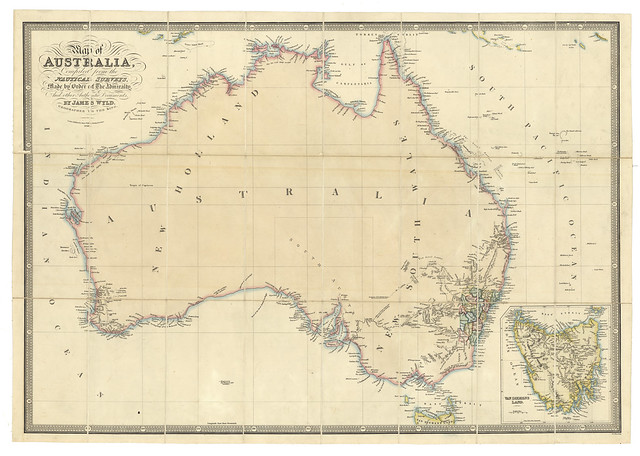
Map of Australia : compiled from the nautical surveys, made by order of the Admiralty and other authentic documents / by James Wyld, Geographer to the King.
Map of Australia showing 19 counties in New South Wales, graphic features, townships and brief descriptions of terrain.
View more information at State Library of South Australia