Photo Library
Map: Part of South Australia, ca. 1851
Hover or tap the map below to zoom in
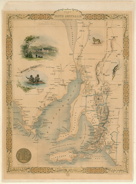
Part of South Australia / the map drawn & engraved by J. Rapkin; the illustrations by H. Warren & engraved by J. Rogers
Originally published within 'Tallis's illustrated atlas and modern history of the world'. London : John Tallis & Company, 1851.
Lithographed Map of part of South Australia from Lake Torrens to Kangaroo Island with placenames and named features and showing counties and mining districts. Mapping of the coast from Elliston in the west to the Coorong in the east, and from Kangaroo Island in the south to Mt. Deception in the north. The depiction of Lake Torrens indicates exploration not very advanced at this date.
View more information at State Library of South Australia