Photo Library
Map: Part of coast of South Australia and Victoria, 1802
Hover or tap the map below to zoom in
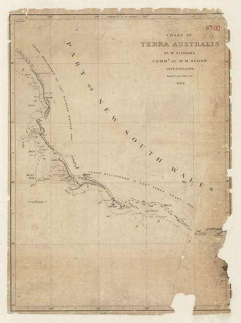
Chart of Terra Australis. Sheet IV, South coast / by M. Flinders, Commr. of H.M. Sloop Investigator, 1802.
Map of the coast of South Australia and part of Victoria from Cape Bernouilli to Cape Otway showing track of Investigator, 1802.
View more information at State Library of South Australia