Photo Library
Map: District of Adelaide, 1839
Hover or tap the map below to zoom in
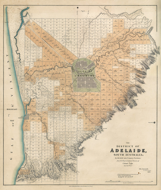
The district of Adelaide, South Australia [cartographic material] : as divided into country sections / from the trigonometrical surveys of Colonel Light, late Survr. Genl. by John Arrowsmith
Cadastral map of the Adelaide region surrounding and excluding the 'City of Adelaide'and showing 443 blocks of land, the smaller lots at 80 acres each with the larger lots at 134 acres each. Lots sold are shown in colour.
View more information at State Library of South Australia