Photo Library
Map: Australia, 1808
Hover or tap the map below to zoom in
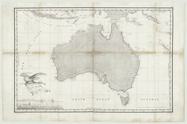
Carte générale de la Nouvelle Hollande dressée par M. L. Freycinet, Comandant la Goëlette le Casuarina, an 1808.
Published in Paris in 1811.
Plate no. 1 from: 'Voyage de découvertes aux terres australes : historique. Atlas. Deuxième partie' / rédigée par Mr. L. Freycinet. Paris : Imprimé par Langlois, 1811
Chart of Australia showing part of the coast seen by Capt. Ruault Coutance in 1804. Relief shown pictorially. This chart was published in 1811 as part of Francois Peron's publication on Baudin's voyage. The chart, drawn by Louis de Freycinet, commander of the Casuarina, depicts Baudin's discoveries in Australian waters. There is no acknowledgement on the chart of Flinders' prior discoveries, even though the Dutch discoveries of the west and southern coastline of Australia are acknowledged. Note the vignette, in the bottom left hand corner of the map, showing the three ships of the French expedition.
View more information from the State Library of South Australia