Photo Library
Map: Plan of the Town of Adelaide, 1837
Hover or tap the map below to zoom in
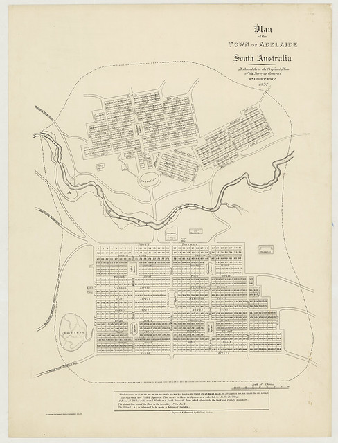
Plan of the town of Adelaide, South Australia: reduced from the original plan of the Surveyor General Wm. Light Esqr.
This map is based on the original plan by Colonel William Light, produced in 1837
Map of north and south Adelaide giving Town Acre numbers and street names. Details include the location of Government House and Barracks on North Terrace and the Botanic Gardens on the western side of the city between two roads to Port Adelaide. South west of the city are two roads to Holdfast Bay and in North Adelaide a storehouse and school can be found. The hospital is in the parklands adjacent to East Terrace.
View more information at State Library of South Australia